Best drones for agriculture mapping have revolutionized modern farming by providing precise aerial imagery and actionable insights. They allow farmers to monitor crop health, assess soil conditions, and optimize irrigation efficiently.
Using drones can significantly reduce labor costs and improve decision-making on farms of all sizes. Research shows that drone-assisted mapping can increase yield efficiency by up to 25% through better resource management.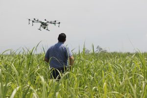
Selecting the right drone depends on farm size, budget, and specific mapping requirements. Key features such as camera quality, flight time, and sensor capabilities determine the effectiveness of aerial surveys.
In this guide, we explore the 10 best drones for agriculture mapping, highlighting their applications for crop monitoring, field analysis, and precision farm management. Each drone has been chosen for its reliability, imaging quality, and ability to provide actionable agricultural data.
10 Best Drones For Agriculture Mapping
1. DJI Phantom 4 Pro+ – Best Professional Imaging Drone for Field Mapping
The DJI Phantom 4 Pro+ is a professional-grade drone designed for high-resolution crop mapping. Its 1-inch 20MP sensor captures sharp images that can be used for orthomosaic mapping. Farmers can monitor large fields and detect crop stress efficiently using this drone.
Equipped with a mechanical shutter, the Phantom 4 Pro+ minimizes motion blur during flight. Its obstacle sensors ensure safer navigation over uneven terrains. The drone supports advanced flight modes like Waypoints and ActiveTrack, optimizing mapping routes.
The Phantom 4 Pro+ is suitable for vineyards, orchards, and large crop fields. Its mapping accuracy allows for detailed vegetation index calculations. Flight time of up to 30 minutes per battery supports extensive coverage without frequent recharging.
Pros:
• High-resolution
• Fast mapping
• Obstacle sensors
• Long flight
• Reliable GPS
• Professional grade
• Accurate data
Cons:
• Expensive
• Heavy
• Requires skill
2. DJI Mavic 3 Multispectral – Best Multispectral Drone for Crop Health Analysis
The DJI Mavic 3 Multispectral comes equipped with RGB and multispectral sensors for crop health monitoring. It can capture NDVI and NIR data for precision agriculture applications. The drone enables early detection of plant stress, disease, and nutrient deficiencies.
Its compact foldable design allows for easy transport between fields. Intelligent flight modes ensure accurate and repeatable mapping missions. Flight time of up to 43 minutes allows for larger area coverage in a single sortie.
This drone is ideal for large-scale farms requiring multispectral analysis. Farmers can generate prescription maps for fertilization and irrigation planning. The integration with mapping software streamlines data processing and visualization.
Pros:
• Multispectral sensors
• Foldable design
• Long flight
• Accurate mapping
• Crop health analysis
• Repeatable missions
• Professional software
Cons:
• High cost
• Complex setup
• Learning curve
3. Parrot ANAFI Ai – Best AI-Powered Drone for Smart Field Surveys
The Parrot ANAFI Ai offers AI-assisted flight planning and high-resolution imagery. Its 48MP camera captures detailed images suitable for field mapping and crop analysis. AI integration allows for autonomous flight and efficient coverage of irregular farm layouts.
With up to 32 minutes of flight time, the ANAFI Ai can survey medium to large plots. Lightweight design ensures portability and ease of use. Its 4G connectivity allows real-time data transmission for immediate field decisions.
The drone is particularly useful for orchards and vineyards where canopy assessment is critical. Field mapping can be conducted without specialized training. Its compact design makes it ideal for farms with limited storage space.
Pros:
• AI-assisted
• High-resolution
• Real-time data
• Long flight
• Lightweight
• Autonomous missions
• Easy transport
Cons:
• Moderate cost
• Limited payload
• Connectivity issues
4. Bwine F7GB2 – Best Long-Endurance Drone for Extensive Field Coverage
The Bwine F7GB2 features extended flight endurance for mapping large agricultural areas. Its adjustable camera provides high-resolution imagery for soil and crop monitoring. This drone allows farmers to cover multiple hectares in a single flight efficiently.
Its GPS-assisted navigation ensures accurate flight paths and repeatable mapping missions. The drone can operate in moderate wind conditions, increasing reliability. Easy-to-use software simplifies mission planning and image processing.
Bwine F7GB2 is suited for crop health monitoring, irrigation planning, and field surveys. It provides actionable insights for better resource management. Large battery capacity reduces downtime during extensive mapping operations.
Pros:
• Long flight
• High-resolution
• GPS assisted
• Large coverage
• Reliable
• Adjustable camera
• Repeatable missions
Cons:
• Bulky
• Moderate cost
• Limited support
5. DJI Mavic Mini 3 – Best Compact Drone for Small Farm Mapping
The DJI Mavic Mini 3 is a lightweight and portable drone designed for small-scale farms. Its 12MP camera can capture detailed aerial imagery for field mapping. Easy-to-use controls make it ideal for beginner farmers and hobbyists.
Flight time of up to 34 minutes allows multiple small plots to be surveyed efficiently. The compact foldable design ensures convenient transport. Integration with mapping apps facilitates creating orthomosaics and crop monitoring reports.
This drone is suitable for home gardens, orchards, and small vegetable farms. Its portability makes it ideal for quick inspections. Despite its size, it provides accurate and actionable mapping data.
Pros:
• Lightweight
• Portable
• Easy controls
• Affordable
• Quick mapping
• Foldable
• App compatible
Cons:
• Lower resolution
• Small sensor
• Limited range
6. DJI Inspire 2 – Best Professional Aerial Drone for Detailed Surveys
The DJI Inspire 2 is designed for professional crop surveys and high-resolution imaging. Its 6K camera delivers detailed orthomosaics suitable for large-scale mapping. Dual-battery capability provides extended flight for covering multiple hectares.
Obstacle sensors increase flight safety over uneven terrain. Advanced flight modes such as waypoint navigation ensure precise field coverage. Compatible with a variety of mapping software for accurate georeferenced imagery.
Ideal for commercial farms, research stations, and agribusiness operations. It offers unparalleled data quality for crop monitoring. Inspire 2 enables repeatable and efficient mapping missions.
Pros:
• 6K imaging
• Professional grade
• Long flight
• Dual battery
• Accurate mapping
• Safe navigation
• Software compatible
Cons:
• Expensive
• Heavy
• Requires experience
7. DJI FPV – Best Fast-Coverage Drone for Rapid Field Inspections
The DJI FPV is built for speed, allowing rapid inspections of large fields. Its 4K camera provides high-quality imagery while flying at high velocities. Ideal for quickly identifying crop issues or irrigation problems.
Flight performance enables coverage of up to several hectares in minutes. Its stability systems reduce motion blur during fast flights. The drone supports both manual and automated flight modes for flexibility.
Best suited for emergency field inspections and quick surveys. Farmers can spot stress areas before it impacts yields. The FPV provides immediate visual insights for actionable decisions.
Pros:
• High-speed
• 4K camera
• Rapid survey
• Stable flight
• Flexible modes
• Fast coverage
• Portable
Cons:
• Short battery
• Learning curve
• Not precise mapping
8. SUMEAUT Foldable Drone with Dual 4K Camera – Best Affordable Mapping Drone
The SUMEAUT Foldable Drone features dual 4K cameras for detailed aerial imagery. Its foldable design allows for easy transport between multiple farm sites. Ideal for farmers seeking a balance between cost and capability.
Flight time of up to 30 minutes allows coverage of small to medium plots. GPS navigation ensures stable flight and accurate mapping. Integration with mobile apps facilitates flight planning and image stitching.
Suitable for orchards, vegetable fields, and pasture mapping. The dual-camera setup enhances visual coverage. It provides an entry-level solution for precision agriculture monitoring.
Pros:
• Foldable
• 4K dual camera
• Affordable
• Portable
• GPS navigation
• 30-min flight
• Easy setup
Cons:
• Limited range
• Basic sensors
• Moderate precision
9. SwellPRO FD3 / Spry+ – Best Rugged Drone for Field and Water Surveys
The SwellPRO FD3 / Spry+ is rugged and waterproof, designed for diverse farm environments. Its 4K camera captures imagery over fields, ponds, and irrigation systems. Resistant to light rain, making it suitable for varied climates.
Long flight times allow mapping of medium to large plots. GPS-assisted navigation ensures stable flight and repeatable coverage. Durable design reduces maintenance costs in rough terrains.
Ideal for farmers with wet fields, aquaculture, or flood-prone areas. The drone can inspect irrigation infrastructure effectively. Ruggedness ensures reliability and reduces downtime.
Pros:
• Waterproof
• Durable
• 4K camera
• Long flight
• GPS assisted
• Reliable
• Field ready
Cons:
• Expensive
• Heavy
• Limited payload
10. Chubory A77 4K Wi-Fi FPV Drone – Best Budget-Friendly Option for Small Farms
The Chubory A77 is an affordable 4K drone with Wi-Fi FPV for aerial imaging. Lightweight and easy to operate, it suits beginner farmers. Provides real-time video for quick inspections.
Its foldable design allows easy transport across small fields. Flight time up to 25 minutes is adequate for small plot coverage. Simple app integration allows basic mapping and image capture.
This drone is best for home gardens, small orchards, and hobby farms. Affordable pricing makes it accessible for first-time drone users. Offers practical aerial insights for farm planning on a budget.
Pros:
• Affordable
• Lightweight
• Foldable
• 4K camera
• Wi-Fi FPV
• Easy controls
• Portable
Cons:
• Short flight
• Basic sensors
• Limited range
Best Drones For Agriculture Mapping (FAQs)
1. What is the best drone for crop mapping?
The DJI Mavic 3 Multispectral is best for multispectral crop analysis.
2. Can small drones map large fields?
Yes, but they require multiple flights to cover extensive acreage.
3. Are these drones suitable for vineyards and orchards?
Yes, compact drones like Parrot ANAFI Ai work well in narrow rows.
4. How long do drones fly for mapping purposes?
Most consumer drones have 25–43 minutes per battery; extended coverage requires multiple batteries.
5. Do I need specialized software for mapping?
Yes, mapping apps help create orthomosaics and calculate NDVI or crop health indices.
6. Can drones detect pest or disease stress?
Yes, multispectral and high-resolution cameras can identify plant stress early.
7. Are these drones expensive to maintain?
Maintenance is moderate; professional-grade drones are more expensive than consumer options.
Conclusion
The best drones for agriculture mapping combine imaging quality, flight time, and advanced navigation for precise field data. The DJI Mavic 3 Multispectral stands out as the best option for detailed crop health monitoring.
The runner-up is the DJI Phantom 4 Pro+, which provides high-resolution mapping and reliable performance for large plots. Compact drones like Mavic Mini 3 are ideal for small farms or budget-conscious farmers. Using drones reduces labor costs, improves resource allocation, and boosts crop yields.
Start applying the most suitable drone technology today to transform your farm management. Collect accurate data, make informed decisions, and ensure healthier, higher-yielding crops with modern agricultural drones.
Recent Posts
The best fertilizer for Vanda orchids is essential for promoting vigorous root growth, lush foliage, and vibrant, long-lasting blooms throughout the spring and summer months. Choosing a fertilizer...
The best fertilizer for kadi patta plant supports healthy leaf production, strong roots, and continuous growth in both pots and outdoor environments. Using fertilizers with an NPK ratio between...